Carlo Günther · 12 October 2026
Targeted Engineering Projects Tackle Slope Movement on Scotland's Popular Coastal Headlands
Engineers have applied a range of stabilization techniques to manage slope shifts at high-traffic Scottish promontories where visitor numbers and natural weathering combine to accelerate ground movement, and data from monitoring stations show incremental displacement rates of several millimeters per month in active zones. These sites attract thousands of daily visitors along paths that cut into steep coastal bluffs, which increases both foot traffic load and the urgency for intervention before larger failures occur.
Research indicates that drainage systems form the first line of defense because excess water reduces shear strength in the soil and rock layers that support these headlands. Teams install perforated pipes and surface channels to redirect runoff away from critical failure planes, while geotextile fabrics line the trenches to prevent clogging and maintain long-term flow capacity. Observers note that such measures have lowered pore-water pressures measurably at comparable sites, and similar installations along the Scottish coast now operate under scheduled maintenance cycles that began rollout phases in early 2025.
Monitoring Networks and Data Collection
Continuous monitoring supplies the evidence base for deciding when and where to intervene, and networks of inclinometers, piezometers, and ground-based radar stations transmit readings to central databases updated daily. In October 2026 a new satellite-linked sensor array came online at several promontories, allowing real-time alerts when movement thresholds are crossed and giving maintenance crews advance notice to close sections before public access becomes hazardous. Figures from these systems reveal seasonal spikes that align with heavy rainfall periods, yet overall trends remain within manageable limits when drainage and reinforcement work proceed on schedule.
Drone surveys supplement ground instruments by capturing high-resolution imagery that reveals surface cracking and vegetation changes invisible from trail level, and analysts compare successive flights to quantify volume loss or heave across entire slopes. Universities in both the United Kingdom and Canada have contributed processing algorithms that convert these images into displacement maps accurate to within a few centimeters, while cross-checks against traditional survey points confirm reliability for engineering decisions.

Reinforcement Methods in Practice
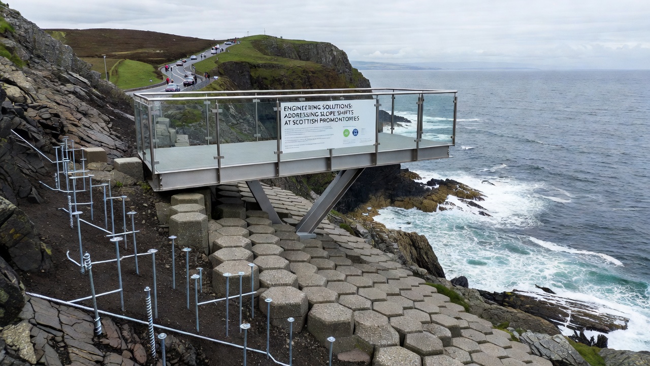
Once monitoring identifies active zones, crews move to physical reinforcement that includes soil nailing, rock bolting, and the placement of geogrid layers that tie surface material to deeper stable strata. At one high-traffic location near the eastern coast, contractors completed a hybrid system combining anchored mesh panels with vegetated crib walls that blend into the landscape while providing immediate structural support. According to reports from the U.S. Geological Survey, comparable techniques have reduced failure frequency by more than half at monitored North American bluffs, and Scottish projects adapt the same principles to local geology that features alternating sandstone and mudstone sequences.
Retaining structures receive additional attention where paths hug the slope edge, and gabion baskets filled with site-won rock offer both strength and permeability that allows water to pass without building pressure behind the wall. Engineers calculate basket dimensions and anchor depths from site-specific shear tests, and construction logs document that each installation undergoes proof loading before reopening the route to the public. These steps occur within tight seasonal windows to avoid peak visitor months, which keeps disruption low while maintaining safety margins.
Integration with Visitor Management
High footfall requires that engineering work accommodate continued access, so temporary boardwalks and rerouted trails divert people around active construction areas while permanent solutions take shape. Signage and timed entry systems further distribute loads, and data collected from trail counters show that spreading visitor pressure reduces concentrated wear on any single slope section. Partnerships with local authorities ensure that engineering crews receive updated usage statistics that inform both design loads and maintenance frequency.
Longer-term strategies incorporate bioengineering elements such as deep-rooted grasses and shrubs whose root networks add tensile strength to surface soils, and trials at several promontories demonstrate that established vegetation can cut surface erosion rates by measurable percentages when combined with structural measures. European Environment Agency summaries of similar coastal projects across member states highlight that integrated approaches deliver both stability and habitat benefits, and Scottish teams now apply these lessons at scale.
Conclusion
Collective evidence from monitoring arrays, reinforcement installations, and visitor-flow adjustments demonstrates that coordinated engineering responses can keep slope movement within acceptable bounds at Scotland's busiest promontories, and ongoing data collection will continue to refine those responses as conditions evolve through 2026 and beyond. Projects already completed provide templates that other coastal regions study when facing parallel challenges of tourism pressure and natural slope dynamics.